Picture red cliffs at sunrise, weekends at the reservoir, and trailheads minutes from home. If you are considering a move to Hurricane, you are likely weighing small-town convenience against access to big outdoor adventures. This guide walks you through neighborhoods, recreation, daily-life essentials, and practical tradeoffs so you can decide if Hurricane fits your goals. Let’s dive in.
Where Hurricane fits in Southern Utah
Hurricane sits in Washington County in southwestern Utah, part of the St. George metro area. It functions as a smaller service center with strong ties to outdoor destinations like Zion National Park and Sand Hollow State Park. The community has grown quickly in recent years, so population figures can change. For current snapshots, review Hurricane’s page on U.S. Census QuickFacts.
You will experience a desert and high plateau climate. Summers are hot and dry, winters are generally mild with cool nights, and low humidity is common. Spring and fall bring peak outdoor seasons, which can increase visitor traffic through town.
In terms of regional access, Hurricane is in the same travel corridor as St. George, Sand Hollow, and Zion. Drive times depend on season and traffic, especially during spring and fall peaks. Plan on roughly local-to-regional drives and check a live map before you go.
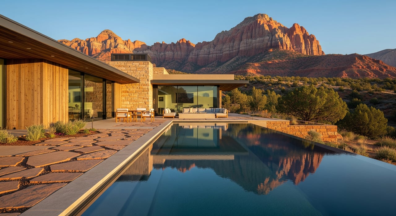
Neighborhoods and housing at a glance
Hurricane offers a variety of neighborhood types and lot sizes. You will find older in-town streets near the small-town core alongside newer suburban subdivisions and rural-feeling parcels on the outskirts.
Historic core and in-town streets
Close to Main Street, you will see an older small-town fabric with a mix of residential and neighborhood-serving businesses. Some homes have mature landscaping and established blocks. If you like being near local services and community events, this area can be appealing.
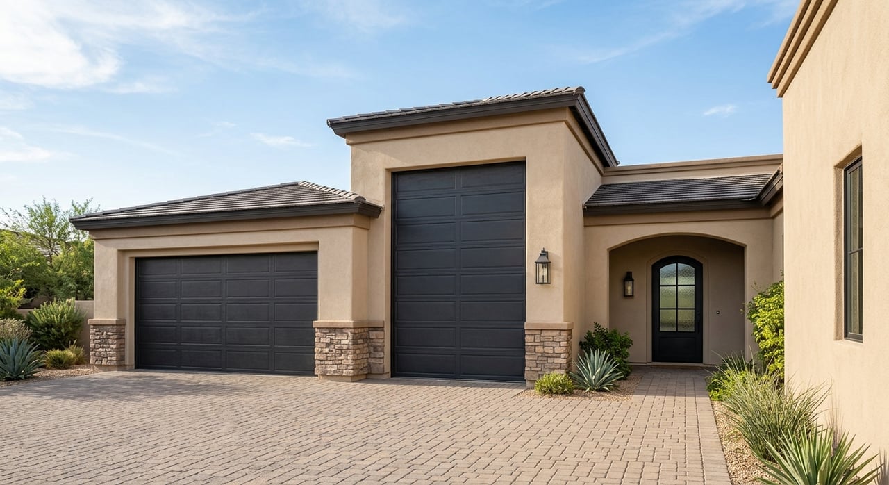
Newer subdivisions and HOAs
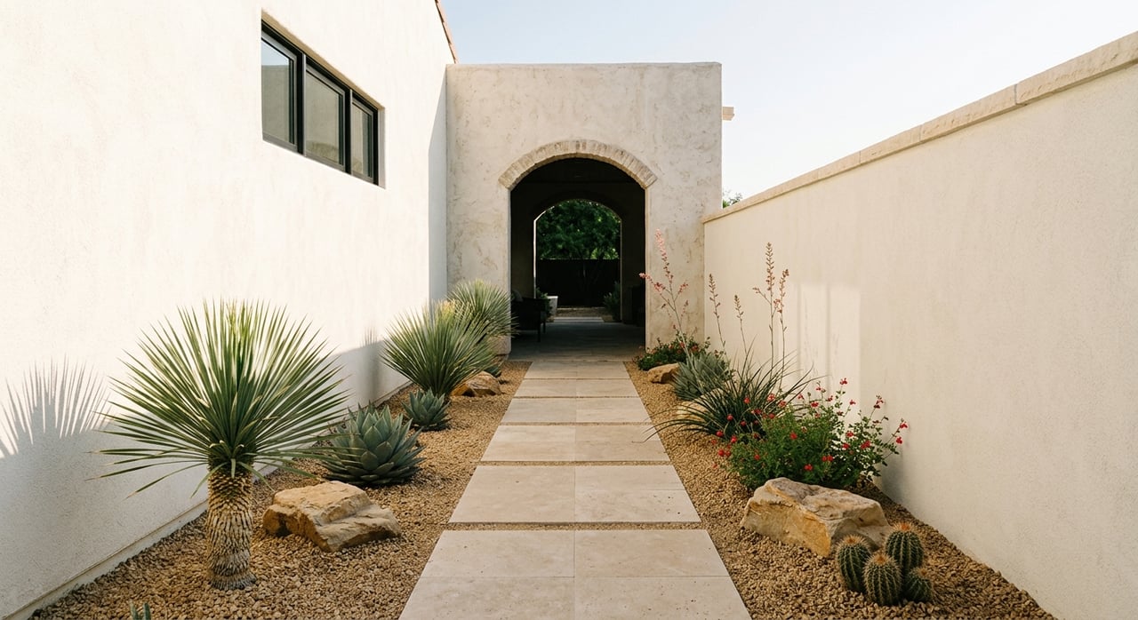
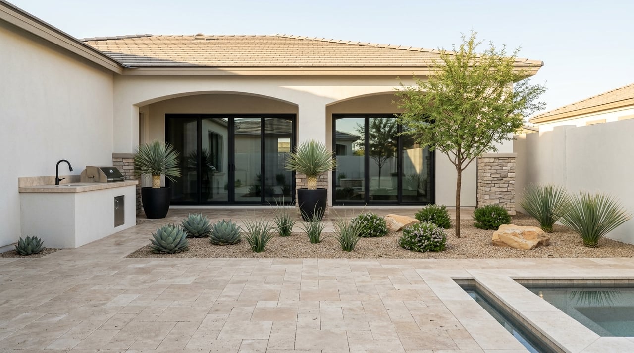
Much of Hurricane’s growth shows up in newer single-family subdivisions. Common styles include contemporary ranch and stucco with tile or shingle roofs. Many neighborhoods use desert-friendly landscaping. Some communities have HOA-managed amenities such as small parks or pools, and newer builds often include energy-efficiency features with layouts that support indoor and outdoor living.
Ranchettes and outer parcels
On the edges of town, larger lots and ranchettes are common. You may see properties that retain agricultural uses, including small orchards and irrigated areas tied to the Virgin River valley. Manufactured-home communities and accessory dwelling units are also part of the local housing mix.
Vacation-oriented areas
Proximity to Sand Hollow and broader recreation draws second-home and short-term-rental interest. Rules for vacation rentals evolve and are specific to zones and licensing. If rental flexibility matters, review current city ordinances and confirm allowed uses with the municipality.
What drives pricing and demand
Hurricane has historically offered a more affordable entry point than larger St. George, though prices shift with inventory and new construction. Buyers often compare views of the Hurricane Cliffs, lot size, and whether a home is new construction or resale. Proximity to recreation areas and whether a property is marketed for short-term rental can also influence value. For current medians and trend lines, use a date-stamped source from your agent or local MLS snapshot to guide expectations.
Outdoors and recreation
Sand Hollow State Park
Sand Hollow is one of Southern Utah’s most popular spots for boating, wakeboarding, lakeside camping, and OHV access on nearby dunes. If your ideal Saturday includes a beach chair and a paddleboard, this reservoir is a major lifestyle perk. For park hours, fees, and lake-use rules, check Sand Hollow State Park on Utah State Parks.
Zion National Park
Zion is a world-class destination and a major reason people choose to live nearby. It brings unforgettable hiking, climbing, and photography. Peak seasons also bring heavy traffic and limited parking in gateway areas. Before you go, review current shuttle operations and trail updates on the Zion National Park conditions page.
Trails, biking, and desert safety
The Hurricane and greater St. George area is a national-level destination for mountain biking and desert trail systems. Expect slickrock segments, technical desert singletrack, and rim trails with sweeping views of the Virgin River valley. OHV routes and dispersed recreation areas also exist on nearby public lands. Desert conditions can be harsh, especially in summer. Carry plenty of water, start early, and watch weather forecasts for flash-flood potential.
Daily life and essentials
Schools and education
Hurricane is served by the Washington County School District, with elementary, middle, and a comprehensive local high school. School boundaries and enrollment change with growth, so review current information with the district. Start your research on the Washington County School District site.
Healthcare access
You will find primary-care clinics and routine services in town. For hospital care and many specialists, St. George functions as the regional hub. Before a move, verify the closest urgent care and hospital locations to your prospective address and typical travel times during peak seasons.
Shopping and dining
Day-to-day needs are straightforward in Hurricane. You will find groceries, hardware, pharmacy options, and local restaurants. For more specialized retail, entertainment, and dining variety, most residents head to St. George.
Utilities, water, and internet
Most in-town properties use municipal water and sewer. Some outer parcels use private wells and septic systems. Water availability and conservation rules matter in the long term. Review guidance from the Utah Division of Water Resources and confirm a specific property’s water provider and any irrigation shares.
Broadband coverage has expanded in Southern Utah, but speeds and providers vary by neighborhood. Check precise availability at an address using the FCC National Broadband Map.
Commuting and getting around
Personal vehicles handle most trips in and around Hurricane. Public transit is limited for many routes. Seasonal visitor traffic can add time to commutes, especially on roads to Sand Hollow and Zion. Many residents describe St. George as a routine commute and Zion as a practical day trip. Plan loosely as roughly local-to-regional drives and confirm with live mapping, especially during spring and fall.
Natural hazards and smart planning
Parts of the Virgin River corridor and low-lying areas may sit within FEMA floodplains. Always verify a property’s status on the FEMA Flood Map Service Center. Wildland fire risk can rise in dry months near the desert interface. Ask about defensible space, firewise practices, and local hazard maps during due diligence.
Hurricane vs. nearby cities
Hurricane vs. St. George
Hurricane offers a quieter small-town feel, often with more attainable lot prices and quick access to trail systems and Sand Hollow. St. George brings larger retail centers, more medical specialists, and broader entertainment and cultural options. If you want action nearby but prefer a residential pace, Hurricane can be a strong fit. If you want maximum convenience and variety, St. George may suit you better.
Hurricane vs. Springdale
Springdale sits at Zion’s gateway and is highly tourism focused. Short-term lodging, dining for visitors, and park services shape daily rhythms there. Hurricane is more residential with a lower daily tourist intensity. If you want easy access to Zion while living in a community geared toward everyday life, Hurricane may feel more balanced.
Remote workers and retirees
Remote professionals often choose Hurricane for lifestyle and lower density. Just confirm broadband at the address. Retirees appreciate mild winters, sunshine, and fast access to the outdoors. As you plan, weigh healthcare access, seasonal traffic patterns, and HOA or maintenance needs that match your pace.
Smart steps for buyers and sellers
A little due diligence goes a long way in a growing market. Use this list to guide your evaluation:
- Confirm zoning and current use permissions, including short-term rental rules and licensing if relevant. Check municipal code and verify with city staff.
- Review HOA covenants, fees, and amenity policies for any HOA-managed neighborhood.
- Investigate utilities. Confirm water provider, sewer or septic, and any irrigation shares or water rights.
- Check hazard maps. Verify FEMA flood status and ask about wildfire risk and mitigation.
- Map commute times to work, healthcare, and school campuses during peak seasons.
- Verify school boundaries and enrollment with the district.
- Evaluate broadband options and speeds at the address using the FCC map.
- Ask about nearby approved or pending developments that may change traffic or views. For regional planning context, start with Washington County’s official site.
- If you plan to boat, ride OHVs, or hunt for trailheads most weekends, map those distances and parking realities during busy seasons.
- For investors, obtain a current, date-stamped rental and sales comp analysis from your agent and confirm all licensing requirements.
Your next move
If Hurricane’s mix of neighborhoods, nature, and everyday convenience fits your plans, the next step is targeted research on specific properties. A local advisor can help you compare subdivisions, confirm utilities, parse HOA documents, and identify opportunities that align with your goals, whether that is a low-maintenance home base, a larger lot with space to spread out, or a vacation-oriented property near the action. When you are ready, connect with Michelle Evans for a local plan tailored to you.
FAQs
How close is Hurricane to Zion and Sand Hollow?
- Hurricane sits in the same regional corridor as Zion National Park and Sand Hollow State Park. Plan for short regional drives and check live traffic, especially during spring and fall peaks. Review park updates on the Zion conditions page and Sand Hollow information.
What types of homes will I find in Hurricane, Utah?
- Expect a mix of older in-town homes, newer single-family subdivisions with stucco and tile or shingle roofs, manufactured-home communities, and larger-lot ranchettes on the outskirts. Some areas are oriented to vacation or second-home use.
Are short-term rentals allowed in Hurricane?
- Short-term rental rules depend on zoning, licensing, and evolving city ordinances. Always verify allowed uses and requirements with the municipality before relying on rental income.
How are public schools organized in Hurricane?
- Hurricane is served by the Washington County School District with elementary, middle, and a local high school. For current boundaries and enrollment, start with the district website.
What should I know about utilities and internet service?
- In-town homes typically have municipal water and sewer, while some outer parcels use wells and septic. Confirm specifics for each property and check address-level internet options on the FCC National Broadband Map.
How can I check flood risk for a property in Hurricane?
- Search the address on the FEMA Flood Map Service Center and ask your agent and insurer how floodplain status may affect financing, insurance, and design choices.